-40%
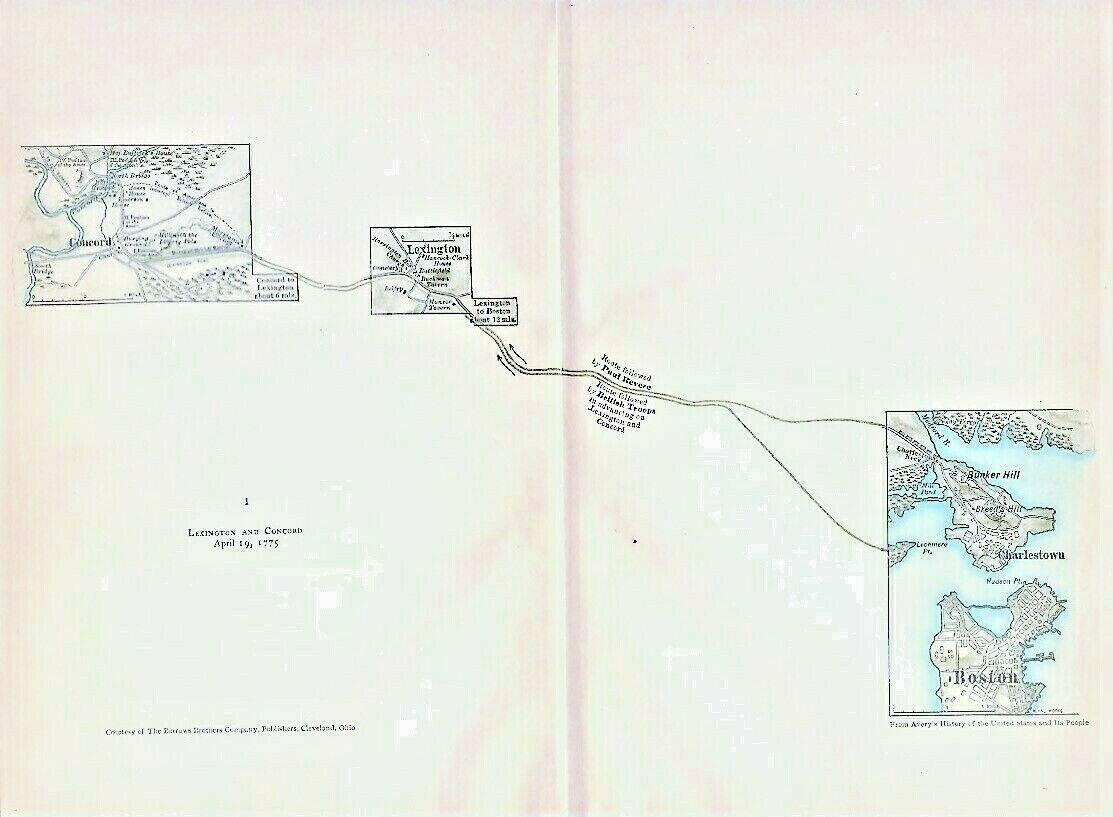
Vintage 1775 Revolutionary War Map LEXINGTON and CONCORD April 19, 1775
$ 4.88
- Description
- Size Guide
Description
For sale here is aRevolutionary War Map.
Map is original as published in 1911 and not a photocopy.
This double page map, which is titled
LEXINGTON & CONCORD April 19, 1775,
accompanied a publication titled "The Revolutionary War and the Military Policy of the United States" which was published in 1911.
A few names I see on Map include Concord, Lexington, Paul Revere's Route, Bunker Hill, Breed's Hill, Charlestown, Hudson Pt., Lechmere Pt., Jones' House, Emerson's House, Buckman Tavern, Munroe Tavern, Belfry, Hancock - Clark House, Medford River, Charlestown Neck, and Boston.
Page measures approx 8 3/4" by 11", map approx 6" by 10" with blank back on lightweight paper. It is in excellent condition.
Satisfaction guaranteed, successful bidder to prepay and include .50 for first class S & H in the US without a tracking number. Thank you.
MAP IS MUCH SHARPER AND CLEARER IN REAL LIFE THAN IT IS IN MY BLURRY SCAN.
Multiple similar items may be combined for a reduction in postage.
.
Track Page Views With
Auctiva's FREE Counter
